![]()
![]()
Historic Illinois
Pavement Tour
• The Lincoln Highway
By Gary Osborne
The first thing one must learn about the Lincoln Highway is that it is not just
a road, but a series of interconnected highways that span the United States.
The original main route that was planned was 3,389 miles in length.
The route as it stands now is more than 5,900 miles if one includes all
the alternate and connecting byways.
The plan for the route was the idea of Carl Fisher, of Indianapolis Motor
Speedway fame, and Henry Joy, the president of the Packard Motor Car Company.
The idea for a route that would go from New York to San Francisco was
proposed in 1912. By 1913 there was
enough support for the route that The Lincoln Highway Association (LHA) was
formed and then began a grand scheme to fund it all across the U.S.
The supporters of the Lincoln Highway had a little bit of a hard time convincing
some people to help pay for the road in their towns.
In order to help them understand the benefits of a solid road through
their communities, the LHA installed “seedling miles” made of concrete all along
the route. This was to show people
that a concrete road would be an economic benefit for them, and their
communities. Not only was that good
for them, but the ease of traveling on a hard surface versus mud was clearly
evident. One of the very first
“seedling miles” was installed in Malta, Illinois.
There was also an “ideal section” installed that had four lanes, lights
on both sides, and foot paths bordering the road.
It is between Illinois and Indiana in the City of Dyer.
However; it is so congested in that area that one would have to park and
walk over to view the monuments next to the road.
In the 1920’s the Federal Government got involved with numbering highways and
assigned several different numbers that were incorporated into the Lincoln
Highway. Once this happened the
Lincoln Highway was numbered from coast to coast even though much of it out West
was still gravel. Eventually the LHA
felt that their goal had been accomplished and the Association was disbanded in
1928.
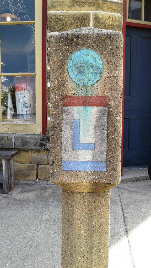
One of the last things the LHA did was to have a group of Boy Scouts help
promote the highway. They travelled
the entire route and helped install concrete “mile posts” all along the way.
Some of the posts have survived to this day and there is one along our
route just outside of Franklin Grove.
In 1992 the LHA was revived with a renewed effort to preserve the history of
this historic road. During this
time, the National Headquarters was established in Franklin Grove, Illinois.
Many of the communities along the route added murals and gazebos to show
how this highway has impacted them and their citizens.
Several of them were along the route that we traveled.
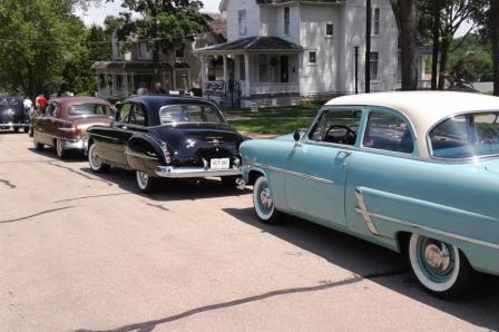
Saturday, June 3, our day for the tour started out looking like rain, but turned
sunny and hot really quick. There
were 15 people that took time to learn a little of the history of this highway
and to travel parts of the route that some didn’t even know were designated as
the Lincoln Highway.
At our starting point I gave a short history talk about the highway, along with
making sure everyone had the maps for the route.
Tom Buscaglia arrived with coffee for all, but unfortunately could not go
on the tour. Our plan was to follow
the original route designated in 1913 as much as possible.
We left Pheasant Run Resort following the highway through Geneva, Elburn,
DeKalb, and into Malta for our first stop.
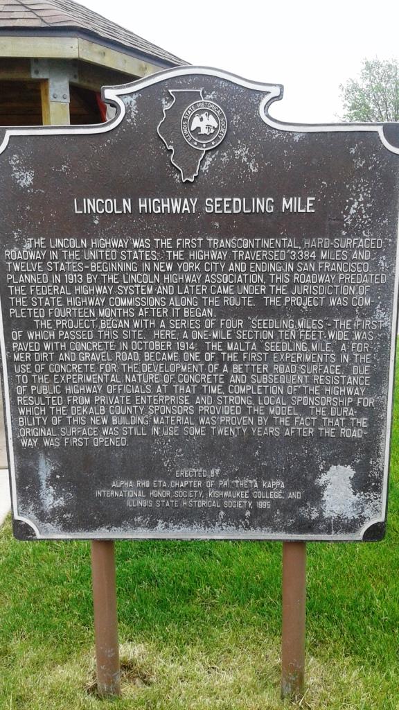
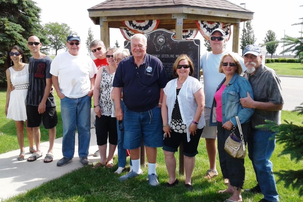
At Kishwaukee College in Malta is a Lincoln Highway gazebo that we needed
to see to help us learn about the Lincoln Highway
This gazebo (like the others on the route) has four panel displays inside
to show travelers some interesting facts about the significance of the Lincoln
Highway through each different town.
This one was about Malta having the first “seedling mile” paved to show the
benefits of concrete over dirt/mud.
We then drove through Creston and Rochelle.
As we approached Ashton, the original 1913 route has 2.5 miles of gravel.
Fortunately for us there is an alternate route to take on pavement to
avoid this. Just before we arrived
in Franklin Grove, I pointed out to everyone to look on the North side of the
Lincoln Highway There, off in the
weeds on the side of the road is an original “mile marker” that was put there by
the Boy Scouts in 1928 as a way of promoting the Lincoln Highway.
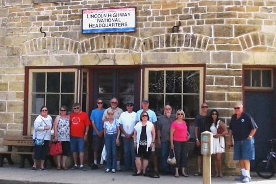
In Franklin Grove we stopped at the LHA National Headquarters.
The building was built in 1860 by Henry Lincoln, a cousin of Abe Lincoln.
There is an interesting history about this building which you can read
about on their website. The front
part of the ground floor is dedicated to the LHA and the other part is an old
general store. Upstairs is being
restored to its original purpose as a community meeting place.
Our next stop was in Dixon for lunch and a visit of Ronald Reagan’s boyhood
home. This home has been restored
back to the condition it was when Reagan was living there.
We viewed a short video about Reagan’s life in Dixon and then entered the
museum. It’s really a small house,
but still maintains the charm of a time gone by.
Out back in the garage was a replica of Jack Reagan’s Model T that had
been restored by the local Model T Club.
After the Museum we drove to “That Place on Palmyra” for lunch.
We were given a private room and had an enjoyable lunch together.
After lunch some started home, but my intentions were to continue on into
Sterling and make a loop on the Lincoln Highway to see some old mansions along
the route before heading home; a few of us did just that.
If you like old houses then you would have seen some in all stages of
restoration. Hopefully, this tour
will inspire more to drive some of the very historic highways that we have in
this state.
Those who attended were Ron and Colleen Steck, George and Dawn Zulas, Tom Zulas
and Denise, John and Barbara Slobodnik and their son John, Gary Osborne, Stan
and JoAnne Stack, John and Robin Emmering, and Joe Serritella.